Arriving North: Hubbard Glacier
- A Little Paddle
- Aug 3, 2023
- 3 min read
We had a bit of a stretch goal. We arrived in Yakutat on July 27th, a few days earlier than expected. The next few days of weather in the Gulf of Alaska were also not so great. So we decided to go for it, and see the Hubbard Glacier.
Hubbard is the largest tidewater glacier in North America. Hubbard Glacier actually originates in Canada, before meeting the ocean in Alaska. It's in Wrangell - St. Elias National Park (U.S.) and Kluane National Park (Canada). It's face is over 15 km wide, standing up to 400ft above the ocean and plunging 250 ft below the ocean surface. And it extends over 100km back into the mountains. For perspective, in the photos below, the Turner Glacier which looks small in the photos and videos below, is over 6km wide. That's more than 2x the size of the glaciers in Glacier Bay National Park. That's not to say bigger is better, but the scale of this place was literally incomprehensible for us from our 18ft kayaks. Even the sounds are best described as "big." It's all just "big."
Hubbard is also special because in and around it are two very unique and rare animals. The Glacier Bear and resident Beluga Whales. We didn't see any, but you best bet we'll be back to try and spot them.
And without further ado, the story of our 2 day & 58 NM trip to Hubbard Glacier:
We lauched from Leonard's Landing at about 9am

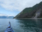
Paddling to Hubbard mostly looks like this. For the first 20 NM, you're crossing Yakutat Bay. There are some islands and sandbars to stop at, but it's a long approach.

The scenery does get interesting though, with coastlines filled with seabirds and even some Grizzly Bears. Lots of fresh landslides.

Rounding Point Latouche, you enter thick ice.

And it gets THICKER. Between the glacial freshwater outflow and the ice, our moving speed slowed from 3 to 1 knots.

We were excited & exhausted when we arrived at Haenke Island, at 7pm. 10h on the water.

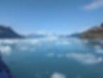
Hubbard is enormous, this is the view 2 NM from the glacier.

Looking over at Turner Glacier on the left, Hubbard on the right, and Beluga Bay in the middle. We weren't able to get close enough with our kayaks in the thick ice to go see the Belugas.

As the tide dropped, our beach became full of ice. It was going to make for an interesting launch in the morning. Bed time.
The view from the water is even more imposing and beautiful. The glacier just keeps going. The tide was flooding and so we were getting pushed into Russel Fjord. Not a place we wanted to be on this trip.

And here we are, at the North most point of our trip. At 59.9905 degrees North, just a few hundred meters south of the 60th parallel, which counts is the BC/Yukon border. But the ice, currents, and long day ahead meant we had to turn around and go back to Canada the long way (south).

We celebrated with a chocolate bar gifted to us by Ada, who we met at the Alaska Whale Foundation from Baranoff Hotsprings and have been carrying for more than a month from for this occasion!
This mini trip ended with a long, 31 NM day where we had to push against the flooding currents and ice to get out of the bay. It was a long day. We'd love to come back to this part of the world, for a week or more, setup a base camp, look for Belugas and Glacier Bears, and enjoy the wonder of Hubbard. Definitely a place best accessed by kayak.